Principles of GIS / Intro to GIS Programming
-
Explore, learn and see how GIS can make a difference in solving today's geospatial problems.
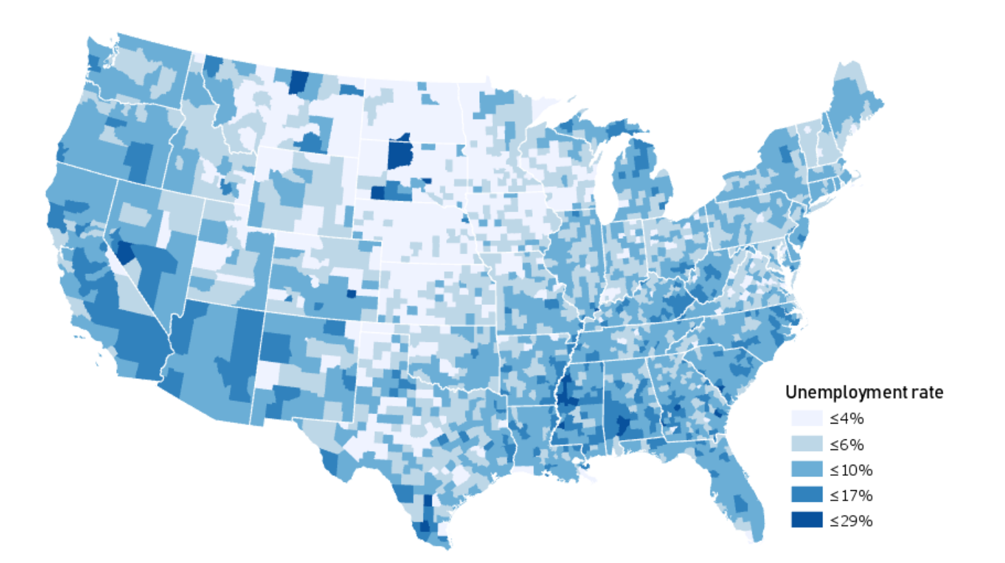
Thematic Mapping
Visualize spatial patterns of data, such as disease outbreaks, population density, or economic indicators. Thematic maps simplify complex data distributions, aiding in rapid analysis and informed decision-making in various fields.
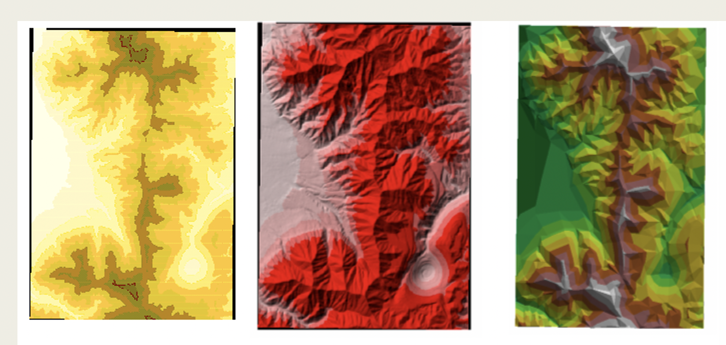
Terrain Mapping
Terrain mapping focuses on understanding the shape and behavior of the Earth’s surface using digital elevation models (DEMs). Learn how elevation data (such as DEMs, TINs, and LiDAR-derived surfaces) can be transformed into meaningful insights about slope, drainage, visibility, and landform structure. These techniques are essential for assessing terrain possibilities, planning infrastructure location, analyzing water flow, and supporting environmental and engineering decisions in real-world GIS project
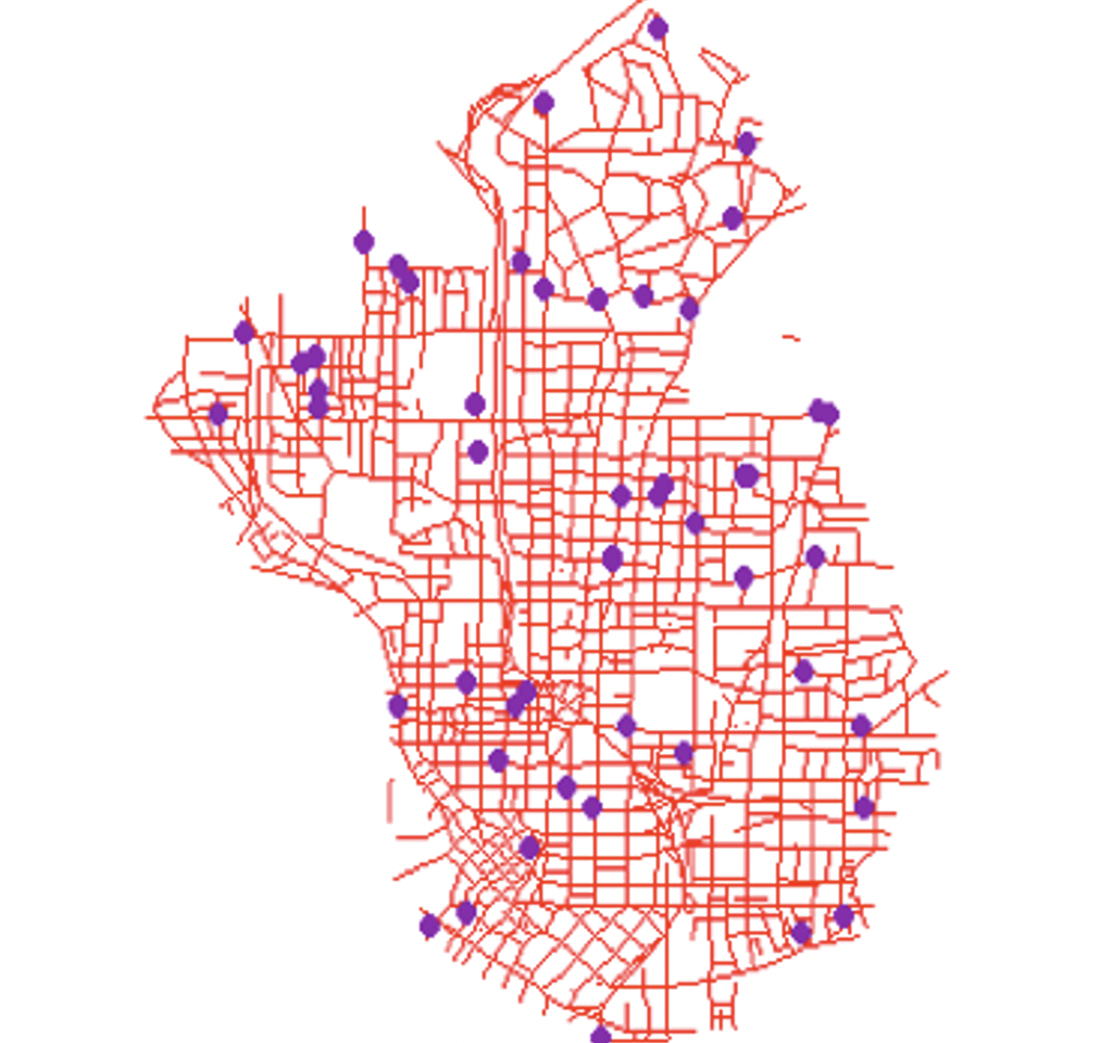
Geocoding Addresses
Geocoding is the process of converting textual addresses into mappable coordinates (latitude and longitude). Geocoding is fundamental for plotting customer and health data, crime and accident locations, or service requests onto a geographic platform for analysis.
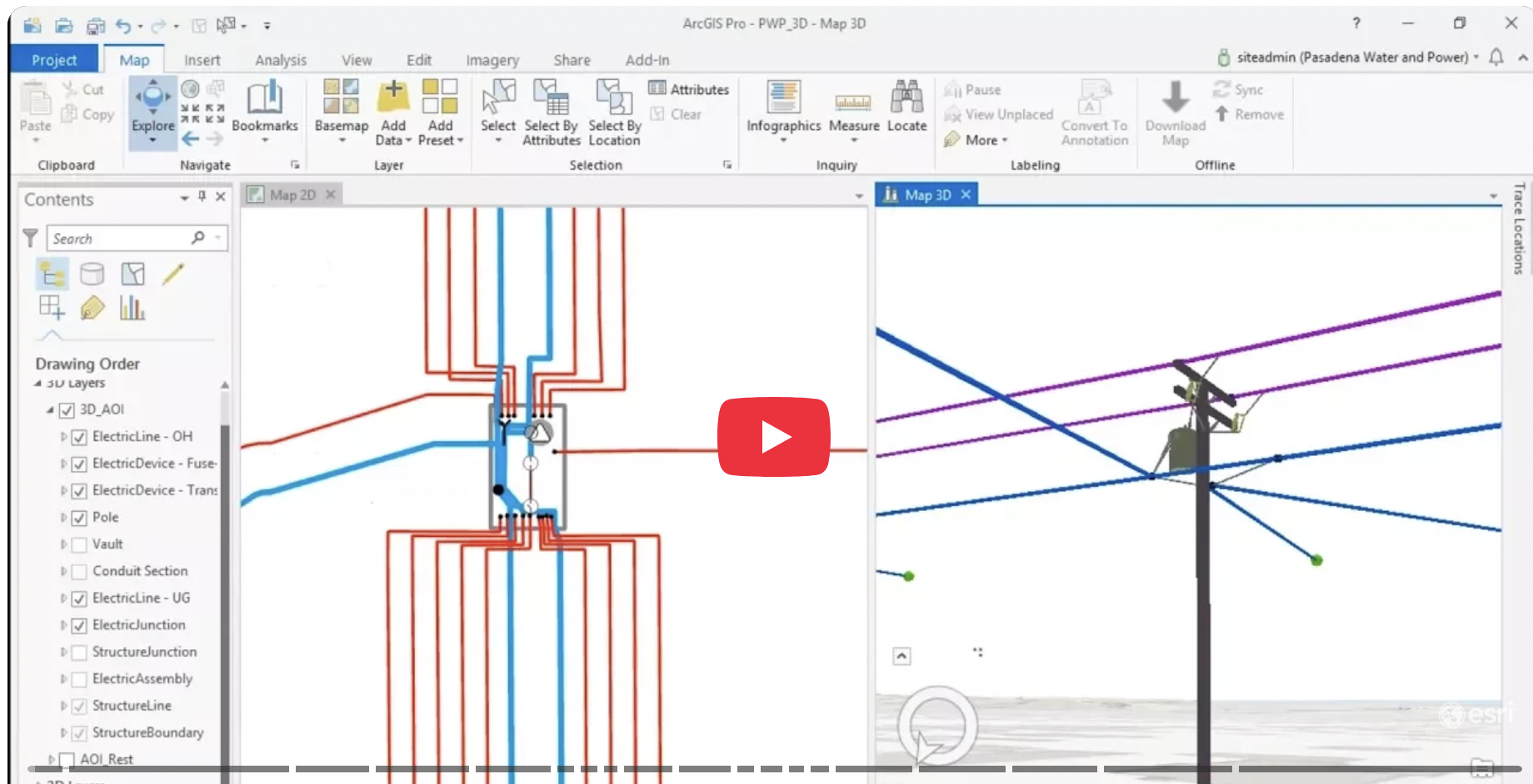
Utility Mapping
Manage and visualize complex infrastructure networks, including water, electricity, telecommunications, gas, and fiber optics. Accurate utility mapping improves asset management, maintenance scheduling, and swift outage response.
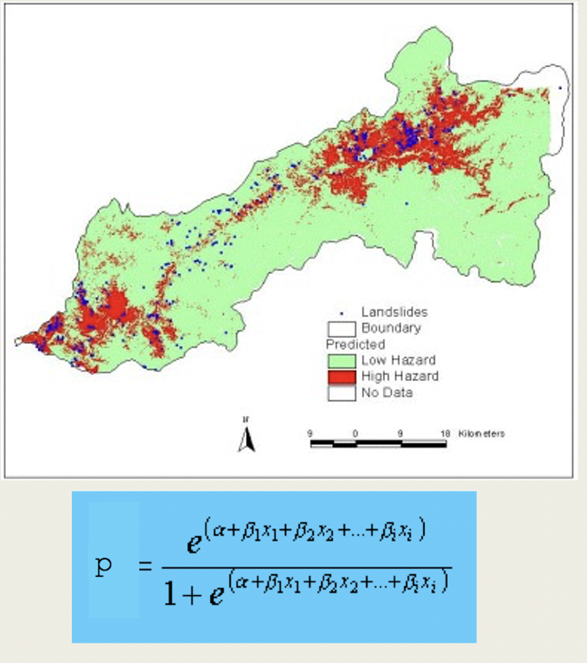
Spatial Analysis
Use proximity, overlay, and statistical tools to discover relationships, patterns, and trends in geographic data. This type of analysis provides insights for site selection, suitability modeling, and environmental impact studies.
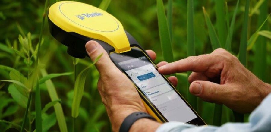
Field Data Collection
Utilize GPS-enabled devices and mobile apps to capture precise geospatial data directly in the field. This ensures data accuracy and speed, replacing traditional paper maps and manual measurements.
Automating Processes with Python
Use Python and its libraries (e.g., ArcPy, GeoPandas) to script and automate repetitive spatial tasks, batch process data, and create customized geospatial applications.

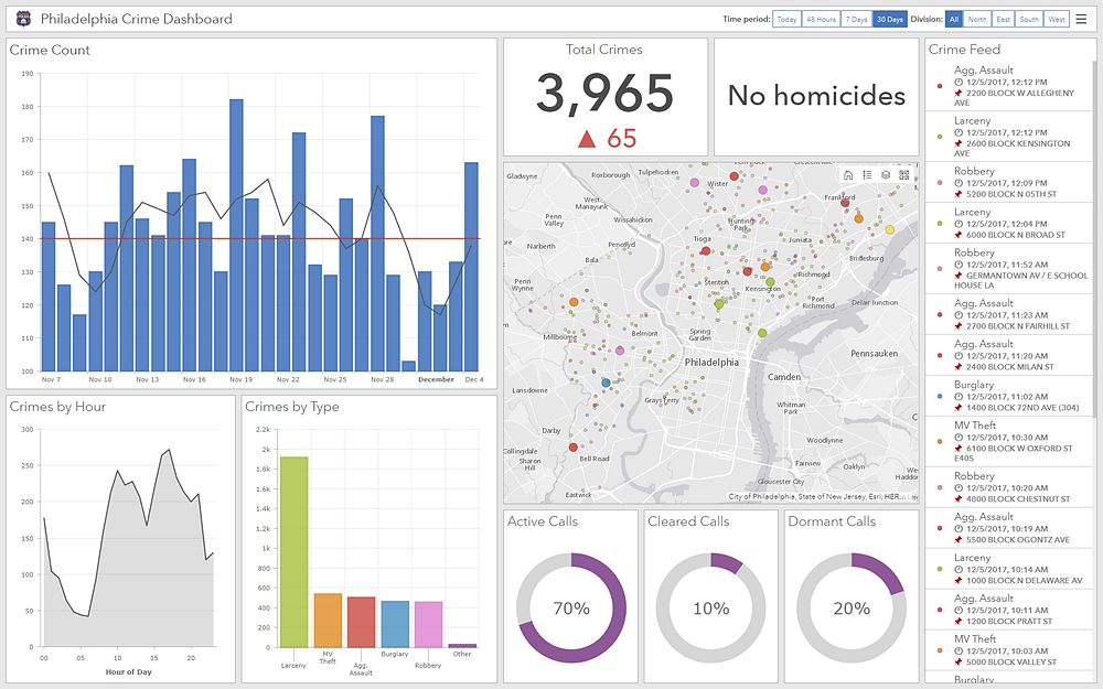
Web Mapping
Use ArcGIS and open source platforms such as Open Layers and Leaflet to publish and share geographic data and analysis results online using interactive web maps. This makes GIS accessible to a wide audience through standard web browsers, supporting collaboration and public engagement. Dashboards
Spatial Data Management & Databases
Learn how GIS datasets are organized using file geodatabases, enterprise databases (PostgreSQL/PostGIS, SQL Server), and hosted feature services. Topics include data modeling, attribute normalization, relationships, indexing, querying with SQL, and managing large, multi-user datasets. These skills are essential for building scalable GIS systems that support dashboards, web apps, and decision-support workflows.

LiDAR Data Processing & Terrain Modeling
Develop skills in using LiDAR data within GIS to generate high-resolution terrain models, building and vegetation layers, and derived products such as slope, hillshade, and canopy height models. Learn how LiDAR enhances flood modeling, infrastructure planning, urban analysis, and environmental assessment by revealing surface features that are not visible in traditional imagery. Emphasis is placed on interpretation, data management, and GIS-based analysis rather than sensor mechanics.

Drone Data Collection & GIS Integration
Drone mapping emphasizes collecting high-resolution spatial data and bringing it into GIS for analysis and visualization. Learn how drone imagery and point clouds are processed into orthomosaics, elevation models, and 3D surfaces, and how these products are used within GIS for measurement, change detection, infrastructure inspection, and site analysis. The focus is on practical workflows—planning drone data capture, validating accuracy, and integrating outputs with existing GIS layers—rather than piloting or aviation theory.

Raster Data & Image Analysis for GIS
Learn how satellite, aerial, and drone imagery are integrated into GIS workflows to support mapping and analysis. Topics include interpreting multispectral imagery, creating raster-derived indicators (such as vegetation or surface moisture indices), performing basic image classification, and combining raster outputs with vector data for decision-making. These skills allow GIS users to incorporate up-to-date Earth observation data into planning, environmental monitoring, and spatial analysis projects.
